This article may reference legacy company names: Continental Mapping, GISinc, or TSG Solutions. These three companies merged in January 2021 to form a new geospatial leader [Axim Geospatial].
Axim Geospatial's Steve Mulberry and Emerson Chew explore the ability to isolate assets within the ArcGIS Utility Network focusing on the Water Distribution Infrastructure.
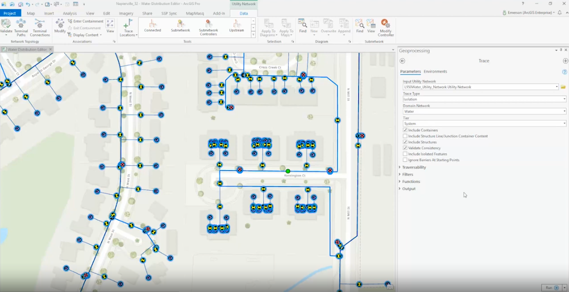
Why is isolation tracing important?
"This capability gives users of the water system the ability to rapidly find and isolate sections of the network that might be affected by a leak and determine what valves are needed to turn off the water flow. This process also allows the GIS team to validate the existence of critical features that might be missing from the GIS that are needed to run the isolation trace. This is a preemptive measure that allows GIS staff to determine if features may possibly be missing from the GIS," says Emerson.
"The ArcGIS Utility Network allows us to access fast, reliable, and authoritative the data on any device anywhere and the ability to perform advanced analytics and functions such as the isolation tracing," says Steve.
Running an isolation trace can help identify and determine if features are missing from the Utility Network Model.
Learn more in this 4-minute VLOG:
Additional Guidance
We hope this article has provided some value to you! If you ever need additional help, don't hesitate to reach out to the Axim team.