This article may reference legacy company names: Continental Mapping, GISinc, or TSG Solutions. These three companies merged in January 2021 to form a new geospatial leader [Axim Geospatial].
A cornerstone to effective asset management is having an understanding of what assets you have and where they're located. Surprisingly, that's still a large challenge for communities and organizations across the country. A geospatial asset inventory is a basis for that understanding which also feeds all sorts of other uses from emergency management, to compliance, to economic development. With an asset inventory that integrates into your enterprise systems, you'll have ready access to the data in the places you need it. And with high-tech sensors that collect data from planes, vehicles, and even indoors, assets can be located and mapped safely, accurately, and quickly.
Here are the top 5 benefits of a geospatial asset inventory:
- It's more than just an X, Y, and Z
Location information is foundational to an asset inventory, but additional data, including detail about the material, condition, and context provides a better understanding of an asset. More information means better evaluation, planning, and data points for current and future use. The additional data is captured by the high-tech lidar and imagery sensors and derived by highly trained analysts and semi-automated extraction processes. -
Data integrates into your enterprise systems
You're not enabled if all the great asset data you have is inaccessible or compartmentalized. Data packages that integrate into your enterprise asset management system (EAMs), your GIS software, and many kinds of enterprise software packages make the data available, and thus useful. Making sure your geospatial asset inventory is packaged correctly for integration is crucial to leveraging your data set. Even better is if your enterprise systems can be extended to make better use of your geospatial asset inventory..png?width=2725&name=TheGeoAnalyst%20Austin%20(1).png)
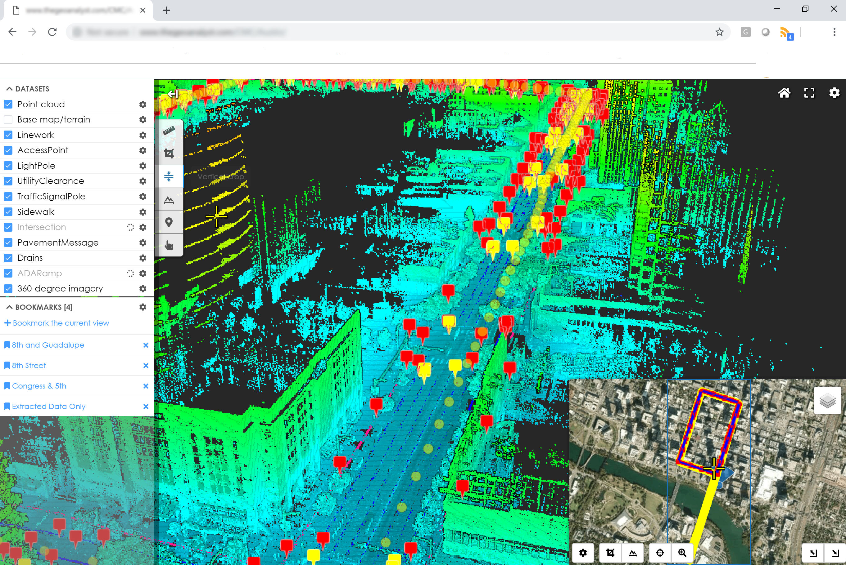
Asset locations are identified in a 3D point cloud, shown in TheGeoAnalyst web viewer
Read more about our statewide asset inventory and assessment for the Minnesota DOT that collected over 500,000 assets and assessed their condition. -
Asset inventories support broad needs
Source data collected once can be used many times to extract data beyond the original interest. The source data and extracted assets are equally useful to other departments, agencies, or partners, promoting collaboration and efficacy. Costs can also be shared across all those participating, creating value with an eye on budgets. Below is a list of many ways an asset inventory can support broad government needs. -
High tech provides more value
High resolution lidar and imagery sensors on vehicles, on backpacks, or on planes collect data quickly and safely. Sensors are mobile and compact and can go pretty much anywhere your assets are. Collections take hours and days, not weeks and months. Mobile lidar collection crews aren't in the roadway putting out cones and signs, so they stay out of harm's way, and the impact to traffic and operations as opposed to traditional collection methods is vastly reduced. -
See the field from the office
3D lidar and imagery data is an additional benefit beyond the asset inventory data: it brings field conditions into the office, allowing engineers and crews to see what's in the field without having to deploy someone to go see what's there. Decision makers have finger-tip access to see and understand field conditions, saving time and resources.
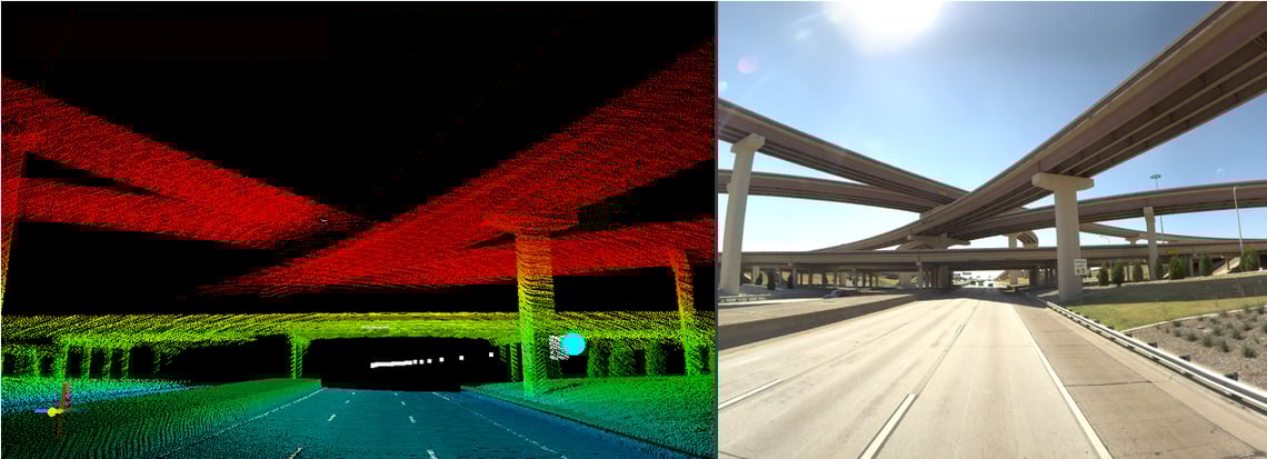 3D point clouds and high-resolution imagery bring field conditions directly into the office.
Axim Geospatial is an experienced geospatial asset inventory provider. We've extracted millions of assets across dozens of projects, from individual sites to cities, to entire networks. Our mobile lidar and backpack sensors are in-house and can be quickly deployed anywhere, nationally and internationally. We understand how to integrate data into enterprise systems, including Agile Assets, Cityworks, ArcGIS, and other Esri products. TheGeoAnalyst is our 3D geospatial data platform, which provides cloud hosting, review, and analysis of geospatial data – perfect to supplement any asset inventory. We have helped local and state governments, as well as private companies, to define their asset inventory needs and tailor fit a solution.
Additional Guidance
We hope this article has provided some value to you! If you ever need additional help, don't hesitate to reach out to the Axim team.