


This article was written regarding work conducted under legacy company names: Continental Mapping, GISinc, or TSG Solutions. These three companies merged in January 2021 to form a new geospatial leader Axim Geospatial.
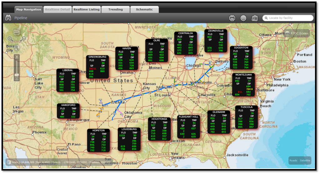
The utility company had a SCADA system that is used to manage the infrastructure, including all the pressure stations, valves, etc. What it needed was a web-based common operating picture interface that could be used to monitor the pipe system, by viewing the SCADA information attached to that system.
The technology selected for the web-based piece was a .NET Silverlight solution, with ArcGIS Server as the backend that serves up the maps and data. .NET is used to communicate with the SCADA system, while Silverlight is used to produce the mapping component. The two together create the casual user interface or SCADA viewer.

