


This article was written regarding work conducted under legacy company names: Continental Mapping, GISinc, or TSG Solutions. These three companies merged in January 2021 to form a new geospatial leader Axim Geospatial.
The City of Daytona Beach, Florida had an established GIS program and had already utilized the services of Axim Geospatial to help with the implementation of the Local Government Information Model (LGIM). With a solid database schema implemented in an Esri best-practice database setup, the City was poised to establish a consistent and expanded online GIS presence.
We worked with the City to help launch their ArcGIS Online account through our ArcGIS Online JumpStart we offer to state and local government clients. The ArcGIS Online JumpStart allowed the City to get up and running quickly by following Esri's ArcGIS for organizational best practices. In this particular instance, the City already had many of the pieces in place to become productive with ArcGIS Online right out of the gate. Our team worked with the City GIS staff to teach them the ins and outs of ArcGIS Online and the best practices for publishing and working with map services within ArcGIS Online. In addition, the City staff learned how to launch numerous maps and applications using ArcGIS Online.
We used ArcGIS Online to set up several of the Esri application templates including:
- Collector App - An application that allows for the collection of real-time data in the field.
- Basic Viewer - A configurable application template used to display a web map with a specified set of commonly used tools and options.
- Finder App - A configurable application template that supports the exploration of feature layers via attribute search. Find, Edit, and Filter App - A configurable application template that supports viewing and editing layers based on a filtered field value.
- Story Map - A configurable Story Map application template featuring a web map, geotagged images or videos, captions, and a thumbnail carousel.
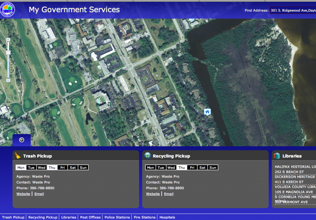
Today, The City of Daytona Beach, Florida has launched a new Maps and Apps gallery within ArcGIS Online featuring their existing investments in the My Government Services and Parks and Beaches Finder. The City has added to its gallery with newly created AGO applications and has set up an internal AGO structure ready for continued growth.

