Axim Geospatial is now an NV5 company!

Learn More

Maximize Your Efficiency, Accuracy, & Impact with Geospatial Asset Management

Don’t let inaccurate, costly, and time-consuming asset management methods prevent you from achieving your mission.

Axim Geospatial helps you make the most out of geospatial asset management solutions, so you can spend less time worrying about your data and systems and more time making the world a smarter, safer place.

Schedule a Meeting

ESRI-partner-network-platinum-logo-intel

ArcGIS-indoors-specialty-logo

software-cityworks

Geospatial Asset Management Doesn’t Have to Be a Headache

When you lack high-quality asset management methods, your data isn’t the only thing at risk. Your organization could lose money and opportunities, your team has less time for more pressing tasks, and you lack the actionable insight needed to make optimal decisions in your industry.

Fortunately, there is an easier way to collect accurate data, manage your assets, and meet mission requirements.

For over a decade, the Axim team has helped dozens of clients collect, identify, and track millions of assets. We take the time to identify the assets most important to you, meticulously collect and deliver the data, and perform integration and analysis to help you determine the best next steps.

With the right asset management solution, you can increase the efficiency of your processes and the accuracy of your data while simultaneously reducing your team’s stress. Schedule a meeting today to build a better-engineered infrastructure that stretches your budget and keeps people safe.

Schedule a Meeting

Watch the Maximizing Asset Management Webinar


How We Help

Inaccurate and incomplete data collection can be a headache for everyone in your organization. Our team is here to make the process simple, dependable, and efficient. Our team uses modern geospatial technology to collect data in the field at the accuracy your organization requires for success.

  • Mobile mapping solutions: Get high resolution, georeferenced 360-degree imagery and highly accurate 3D lidar point clouds without adding extra stress to your plate. Axim Geospatial offers mobile mapping solutions at highway speeds for mapping along right-of-ways, as well as indoor mapping with compact, backpack-mounted sensors.
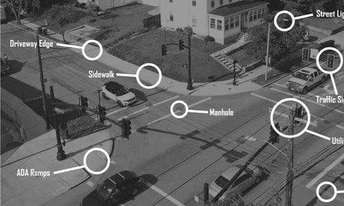
  • Aerial mapping solutions: A bird’s eye perspective offers valuable angles and quick collection of large AOIs. From various aerial platforms, we deploy high accuracy sensors for collecting aerial imagery (including RGB and NIR) and aerial lidar, capturing detailed 3D point clouds from which many mapping products (including digital twins) can be built.

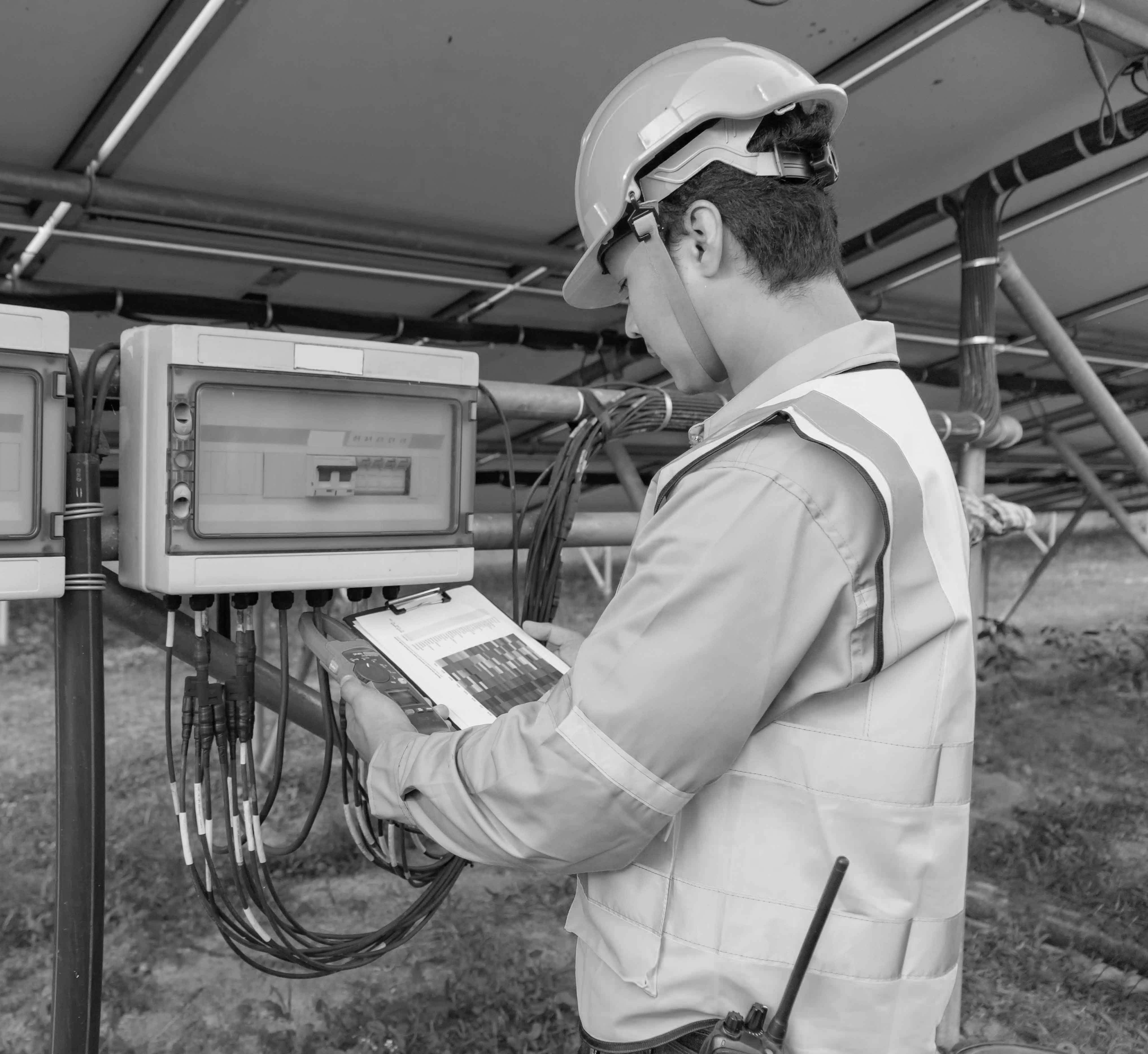
We understand how frustrating it can be when your geospatial partner stalls your project. So our skilled management will keep your project moving efficiently from start to finish, while experienced field crews perform safe and fast source data collection across the country.

We know how stressful data extraction can be for your team. Whether you have large volumes of data to comb through or simpler workflows to evaluate, our team will help you understand what assets and attributions are important to your success.

Once we have defined the critical asset data, our skilled geospatial analysts use defined data dictionaries, powerful software, and proven processes to extract it so you can focus on your other tasks. We also employ artificial intelligence and automation to expedite feature extraction with high accuracy.

Throughout the process, strict quality control will ensure the accuracy of asset location, type, condition, and a host of other descriptive attributes. This helps you gain valuable insight out of your data for improved decision making.

Locating and extracting data are one thing. Determining the best way to utilize that data is something else entirely.

We bring asset data where you need it most. With our software solutions, you can understand and engage with your asset inventory data in all types of applications—ensuring your data drives action and makes a difference.

Additionally, we provide asset data in the formats you work with, loading it into:

  • Enterprise asset management (EAM) systems (like Cityworks
  • Standalone portals
  • CAD and industry-specific engineering software

Are you feeling overwhelmed setting up your enterprise asset management system? Or do you have an existing system that your team is struggling to maintain on their own?

As Cityworks Platinum Partners and Platinum Esri Partners, we have experience working with many asset management systems. Together, we will take steps to ensure your solution fits your needs as they grow.

We can support you in your AMS implementation and services, including:

  • Strategies
  • Configuration
  • Reporting
  • Analytics
  • Customizations

Relying on outdated data storage is not just a potential security risk. It is also a frustration to your team. Cloud hosted geospatial data reduces burden on IT resources and allows for data to be securely accessed from anywhere, including in the field. 

Our team provides our clients with secure and reliable cloud hosting for large geospatial data sets. We are experienced in hosting data across industry standard platforms, including Microsoft Azure and Amazon Web Services (AWS).

Talk with an Expert

Watch the Maximizing Asset Management Webinar


Resources to Help You
Get More from Your Asset Management


Asset Inventory Graphic-01
Top 5 Benefits of Geospatial Asset Inventory

Accurate, easily accessible data remains a constant struggle for many organizations. A geospatial asset inventory can make all the difference. In this article, we explore some of the many reasons why organizations are taking advantage of asset inventories.

Read the Blog


MNDOT_MaverickDeploymentPics (1) (1)
How One State Department Collected 550,000+ Assets over 15,000 Miles

When a study revealed that improperly installed guardrail end terminals played a role in over 1200 auto accidents, the Minnesota Department of Transportation knew they needed to take action. Find out how a statewide asset management system helped them save countless lives.

Read the Case Study


CDOT Bridge 5 (2)
Asset Inventory Best Practices for Local Governments

Asset inventory can support emergency services, public hearings, economic development, and more, but many communities struggle with data collection. These best practices help you overcome common challenges local governments face, from limited resources to bad weather.

Watch the Video Now


testimonial image

“[Axim Geospatial]’s approach to problem-solving demonstrated the effectiveness web-based services and data utilization have on government decision-making. Their performance improved AMC's geospatial landscape, providing additional benefits to the United States Air Force.”

Angie Port
Contract Specialist
Air Mobility Command (AMC)

Free Webinar: Maximizing Asset Management

Getting accurate data is a struggle on its own. However, on top of that, many local governments face additional struggles with their asset management such as:

  • Extensive assets with limited resources to monitor them
  • Environmental factors like weather and seasonal conditions
  • Compliance and safety issues
  • Varying levels of asset inventory

How can you overcome these challenges to improve workplace efficiency, eliminate manual processes, and gain actionable insights?

Watch our free webinar, Maximizing Asset Management: A Geospatial Approach. In this webinar, we discuss actionable steps you can follow to reduce friction in your asset data collection, extract the most value from the data, and integrate that data into your business systems for maximum benefit.

Watch Now